
Sports
Suspect arrested after vehicle burglary attempt in Kissimmee
By Katherine Langford
Advertisement · Why this ad?
Katherine oversees editorial operations across all six brands. Before joining The Meridan Group, she spent 14 years at the Minneapolis Star Tribune, where she led the metro desk through its digital transformation. She holds a Master's in Journalism from Northwestern's Medill School.
More from Katherine →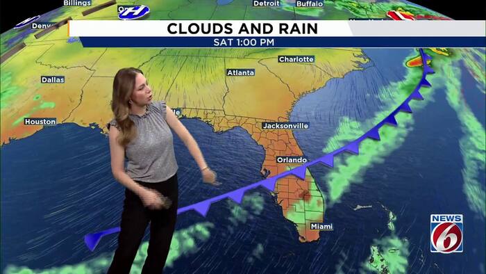
Central Florida is getting a break from the heavy rain, but the flooding story is far from over. Water from this week’s excessive rainfall upstream is continuing to move north through the St. Johns River basin, and river levels could get worse before they begin to improve.A few showers are possible today, but widespread rainfall is not expected. A cold front will move through Saturday, bringing somewhat cooler temperatures for the second half of the weekend.St. Johns River UpdateEven though the heavy rain has moved out, water from the upper St. Johns River basin is still making its way downstream.A prolonged river flooding event is ongoing, especially along the St. Johns River. With a considerable volume of water moving north, conditions are likely to worsen before improvement begins.Friday ForecastMoisture will increase slightly ahead of an approaching front, bringing a few isolated showers into the afternoon.Temperatures will stay warm, with highs reaching the mid-80s and light winds
By Katherine Langford
By Marcus Chen

By Katherine Langford

By Marcus Chen